Community Corner
UPDATED: Rain Causes Road Closures In Vienna, Fairfax
A map and listing of closed roads and advisories in and around Vienna


Update 8:30 pm. At 495N near 66 E, congestion is causing backups three miels long.
66 W at mile marker 49 in Arlington is also backed up, with congestion lasting two miles.
An update on road closings from Fairfax County:
Find out what's happening in Viennawith free, real-time updates from Patch.
- I-495 in both directions at Cameron Run
- I-66 West Bound, exit to route 50, exit 57, being closed due to water
Station 3 (McLean)
- Old Courthouse/Besley
- Oberon Way/Capulet Ct
- 1362 Kirby Road
- Swinks Mill Rd/Georgetown Pike
Station 5 (Reston)
Find out what's happening in Viennawith free, real-time updates from Patch.
- Baron Cameron/Hunter Mill
- Lawyers Road/Hunter Mill
- Rt 7/ Colvin Run Rd
- 11226 Beach Mill Road
- Beach Mill/Olympia Way
- Beach Mill/Utterback
Station 8 (Fair Oaks)
- Towlston Rd and between Dominion & Georgetown Pike (193)
Update 6:48 p.m.: On I-66 at mile marker 64, standing water is causing delays. The east entrance ramp is closed.
Update 6:44 p.m.: Nearly 300 people are without power in the Lawyers and Malcolm Road area of Vienna.
Dominion Power outage maps say the outage is still pending investigation.
Update 6:40 p.m.: The National Weather Service's Flash Flood warning is now in effect until 9:15 p.m.
Update 5:56 p.m.: Thoreau Middle School has canceled its back to school night.
Update 5:44 p.m.: The Church of the Good Shepherd, 2351 Hunter Mill Road, has sustained major water damage, the church wrote on its website.
Phones are also out, though some cell phone coverage remains.
The church canceled all meetings for Thursday.
"The church staff and leadership will be reassessing our ability to reopen tomorrow, Friday, September 9," the church wrote.
Update 5:37 p.m.: Twitter user BrianCWilson says Beulah Road is blocked just past the Toll Road.
"No way out but to turn back," he wrote.
Update 5:26 p.m.: Fairfax Connector Route 480 (Wolf Trap Express) will operate for this evening's performance, but riders should expect delays.
Update 5:24 p.m.: There is flooding at Birdfoot Lane and Stuart Mill Road off of Vale, says reader Ann Costello. Cars that are stranded are blocking the road.
To interact with a map of all area closures, click here. Scroll to the bottom of the article for our original list of closures.
Update 5:17 p.m.: Sections of 50 East and West are closed around 123.
Update 5:05 p.m. Route 123 heading toward Oakton appears to be backed up even more than it usually is during evening rush hour.
Cars barely budged through Vienna around 5 p.m., a problem that extended all the way back to Tysons, according to Twitter users.
Police are urging motorists to stay off the roadways.
The National Weather Service's Coastal Flood Advisory is in effect until 8 p.m. Thursday.
Update 4:54 p.m.: Hunter Station Road Bridge is flooded and closed between Lawyers Road and Hunters Den Ln, wrote in reader Larry Howell.
Hunters Den Lane is also flooded, seen in the picture in the media gallery above; the water is rising toward the sign marking the road.
Parts of Route 29 are also flooded
Update 4:37 p.m.: Hunter Mill Road is closed at 267, and drivers can not get on 267 from Sunset Hills Road, a Vienna Patch reader wrote in an email.
Hunter Mill is also flooded just past Browns Mill.
"[The] only alternative for those traveling east toward Vienna is the toll road. You can get on at Wiehle Ave. Old Courthouse Rd is flooded after Creek Crossing," reader Chandra Townsend wrote.
Original
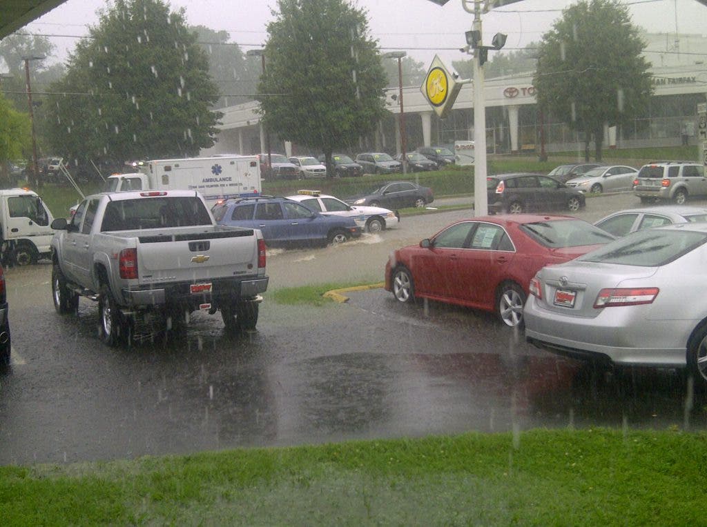
Roads in and around Vienna began to close Thursday afternoon as rain continued to pummel drivers in Northern Virginia.
Lawyers Road -- a typical spot for flooding during heavy storms -- was one of the first roads to close off to drivers, beginning around 2:48 p.m. at Garrett Road.
We'll update this map and list as more closures are put into place.
Did you pass a road closure? Tell us in the comments or email erica.hendry at patch.com
To interact with the map, click here
CLOSED
- NEW FROM FAIRFAX COUNTY Rt 50 is closed in front of Fair Oaks Mall due to flooding, please avoid the area if possible
- NEW READER REPORT: Browns Mill Road, Vienna
- NEW READER REPORT: Hunter Mill Heading South From 267
- NEW READER REPORT: Hunter Mill at Difficult Run
- I-495 NB Right Shoulder at MM 46: Motorists should expect delays on 495 N, there is standing water after the entrance from Chain Bridge Road
- Lawyers Road, beginning at Garrett Road
- Tapawingo Road between Lullaby and Park
WEATHER ADVISORYS
The Virginia Department of Transportation has issued flood advisories for the following roads
I-495N Mile marker 49.8 Mile marker 49.8 Advisory Flood 09/08/2011 02:38 PM I-495N Mile marker 46.0 Advisory Standing Water 09/08/2011 02:06 PM I-495S Mile marker 47.0 Mile marker 47.0 Advisory Flood 09/08/2011 02:38 PM I-66E Mile marker 64.7 Mile marker 64.7 Advisory Flood 09/08/2011 02:38 PM I-66E Mile marker 66.8 Mile marker 67.0 Advisory Flood 09/08/2011 02:38 PM Primary From To Condition Reason Last Update US-50E the ramp from Gallows Road and I-495S the ramp from Gallows Road and I-495S Advisory Flood 09/08/2011 02:38 PM US-50W the ramp to Rt. 650 (Gallows Road) the ramp to Rt. 650 (Gallows Road) Advisory Flood 09/08/2011 02:38 PM VA-267W the ramp to I-495N (Capital Beltway) Mile marker 26.6 Advisory Flood 09/08/2011 02:38 PM US-50E Townwood Dr; Rt. 7470N/S (Fairfax County) Waples Mill Rd; Rt. 665E/W (Fairfax County) Closed Flooded 09/08/2011 04:53 PM US-50W the ramp to Rt. 650 (Gallows Road) the ramp to Rt. 650 (Gallows Road) Advisory Flood 09/08/2011 04:53 PM US-50W Highland Oaks Dr; Rt. 4840N/S (Fairfax County) Waples Mill Rd; Rt. 665E/W (Fairfax County) Closed Flooded 09/08/2011 04:53 PMGet more local news delivered straight to your inbox. Sign up for free Patch newsletters and alerts.


